
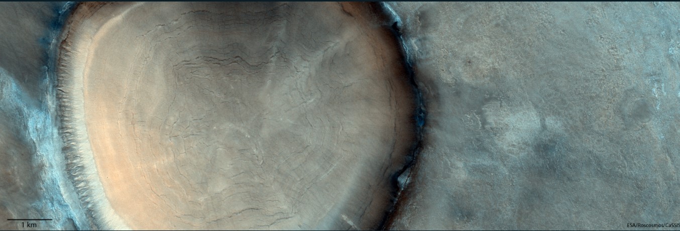
Is this a closeup of a tree stump, or a view of an impact crater? It might be hard to tell at first glance. Climate scientists on Earth get climate history data from tree rings, but planetary scientists on Mars get an image of a crater.
This picture was taken by a camera on the TGO, which arrived at Mars in 2016 and began its full science mission in 2018).
There is a crater in the northern plains of Acidalia Planitia. The famous Cydonia region is located north of Valles Marineris, and the plain contains it.
Why does the crater look different? According to the scientist from the mission, the interior of the crater is likely composed of ice-rich material and could be the result of seasonal changes in temperature that cause cycles of expansion and contraction of those materials.
There are possible gullies along the crater rim on the left.

The inclination of the planet's spin axis allowed deposits of water-ice rich soil to form at lower latitudes. Mars has a similar tilt to Earth, but it has changed over time.
Understanding the history of water on Mars and if this once allowed life to flourish is at the heart of the missions.

The second ExoMars mission will include a Russian built lander that will bring the Rosalind Franklin rover to the surface of Mars. The mission is scheduled to launch in September of 2022. When the rover arrives on Mars in 2023, it will look for signs of life in a region that once hosted an ancient ocean.
The source is the European Space Agency.


