Earth now has an orbital eye to observe our planet's changing conditions.
Landsat 9 was launched on September 27, 2021, continuing the nearly 50-year Landsat satellite family's tradition of providing critical observations for energy and water management, forest monitoring and human and environmental health.
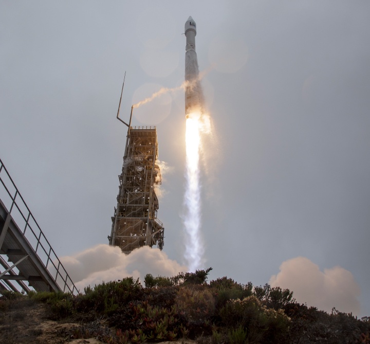
Liftoff! What are you waiting for?
At 2:12 PM ET, the #Landsat 9 satellite lifted off from Vandenberg Space Force Base in California on a @ULALaunch Atlas V rocket. pic.twitter.com/O6YXhtf7kT NASA (@NASA) September 27, 2021
Vandenberg Space Force Base, California was the launch site for the mission. The Atlas V rocket carried the payload and booster. About 16 minutes after launch the payload and booster were in orbit. Landsat 9 was released from the rocket around an hour later. It joined Landsat 8, which has been orbiting since 2013, along with the rest NASA's Earth-observing fleet.
Landsat is a joint mission of NASA and the U.S. Geological Survey. In 1972, the first Landsat was launched.
Karen St. Germain is the director of NASA Headquarters' Earth Science Division. She said that Landsat is unlike any other mission. Landsat satellites have been monitoring our planet for nearly 50 years. They provide unparalleled records of the planet's surface changes over time, from days to decades. We have been able provide timely and continuous data to users, from scientists to resource managers to farmers. These data are useful in helping us to predict and plan for the future, even when it is changing.
Landsat 9 is currently on its final orbital altitude, 438 miles (705 km). It will orbit in a Sun-synchronous, near-polar orbit.
The combined power of Landsat 8 & 9 allows for the simultaneous capture of the entire planet every eight days. Researchers and scientists use the images to track phenomena such as agricultural productivity, forest health and extent, water quality, coral reef health and glacier dynamics.
Anyone can view or use these images. Landsat data over the years is available at this USGS website. Other images of Earth orbit can be viewed at the NASA Earth Observatory website.
Landsat imagery can be used to monitor natural catastrophes such as these comparison photos showing before and after images for flooding of the Ohio River and Mississippi Rivers in 2011. Credit to NASA/USGS.
This launch marks a significant milestone in the almost 50-year-old partnership between NASA and USGS. These two organizations have worked together for decades to gather valuable scientific information and then use that data to inform policy. Landsat 9 will provide imagery and data to support science-based decisions regarding key issues such as water use, wildfire impacts and coral reef degradation.
Landsat 9 has two instruments aboard: the Operational Land Imager 2 and the Thermal Infrared sensor 2 (TIRS-2). The two instruments, which work together, can measure 11 wavelengths reflected or radiated from the Earth's surface using the Operational Land Imager 2 (OLI-2) and the Thermal Infrared Sensor 2 (TIRS-2). These instruments will capture scenes over a distance of 115 miles (185 km) as the satellite orbits. These images show an area of approximately 98 feet (30 metres) in size, which is roughly the same as a baseball field. NASA claims that this resolution will allow resource managers to identify all crop fields in the United States.
As of 2019, Earth orbiting satellites are available for missions and reconnaissance. Credit: NASA
Additional reading: NASA Earth Observatory, NASA blogs


