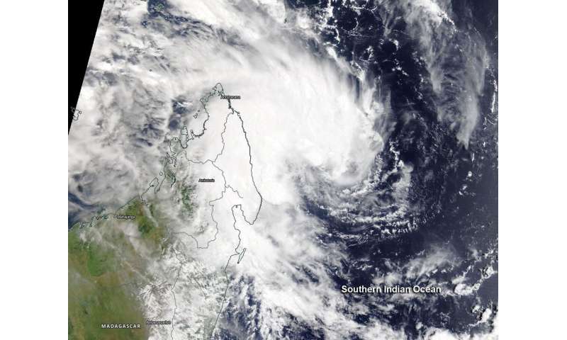
NASA's Terra satellite passed over the Southern Indian Ocean and provided forecasters with a visible image of newly formed Tropical Storm 22S, located near northeastern Madagascar.
The Moderate Resolution Imaging Spectroradiometer or MODIS instrument aboard Terra provided a visible image of Tropical Cyclone 22S that revealed strong thunderstorms had circled the center of circulation and western quadrant. A banding of thunderstorms on the western side were bringing rainfall and gusty winds to northeastern Madagascar. Satellite imagery also shows the storm consolidating.
At 0900 UTC, (5 a.m. EDT) Tropical Cyclone 22S was located near latitude 14.3 degrees south and longitude 52.4 degrees east, about 447 nautical miles north-northwest of Port Louis, Mauritius. 22S was moving to the west-southwest and had maximum sustained winds near 35 knots (40 mph/65 kph).
The Joint Typhoon Warning Center (JTWC) expects 22S to curve to the southeast and pass between Mauritius and Rodrigues. The storm will strengthen to 90 knots (104 mph/167 kph) before becoming subtropical.
Provided byNASA's Goddard Space Flight Center
All Rights Reserved © 2024


